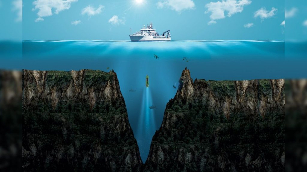
An illustration of Mariana Trench, the deepest point on Earth. (Image credit: DOERS)
The deepest depths of the sea are found in the crescent-shaped Mariana Trench, located in the western Pacific Ocean. But what is the deepest point of the Mariana Trench?
The Mariana Trench is about 1,580 miles (2,550 kilometers) long and located to the east of the Mariana Islands, which give the trench its name, according to the University of Washington (opens in new tab). The deepest spot in the Mariana Trench is a valley called the Challenger Deep, located at the Mariana Trench’s southern end, according to the National Oceanic and Atmospheric Administration (opens in new tab) (NOAA).
According to NOAA, the Challenger Deep extends about 35,876 feet (10,935 meters) below the surface. That makes it about 7,000 feet (2,100 m) deeper than Mount Everest is tall, NOAA noted (opens in new tab).
NOAA’s estimate comes from a 2021 study in the journal Deep Sea Research Part I: Oceanographic Research Papers (opens in new tab), based on data from a 2020 voyage. However, there are many other estimates of the depths of the Challenger Deep. The first crewed mission there, in 1960, returned an estimate of 35,797 feet (10,911 m), according to Guinness World Records (opens in new tab). Since then, recent estimates have included 36,069 feet (opens in new tab) (10,994 m) and 36,036 feet (10,984 m (opens in new tab)).
Why is estimating the depth of the Challenger Deep so challenging? “Fundamentally, it is difficult because it is so deep,” Cmdr. Sam Greenaway of the NOAA Corps and lead author of the 2021 study, told Live Science.
A map of the Mariana Trench in the Pacific Ocean. Its deepest part, Challenger Deep, is highlighted in red. (Image credit: Dimitrios Karamitros)
Related: What are the deepest spots in Earth’s oceans?
To measure ocean depths using modern instruments, scientists basically have two options: sonar mounted on a ship on the ocean’s surface, or a pressure sensor deployed on the seabed that can help gauge how much water lies above it, Greenaway said.
Sonar beams from multibeam echo sounders “can produce complete coverage of the seabed,” said Greenaway, the marine operations lead on NOAA’s new ship construction team. “As good as they are, the ship systems are really far from the seabed, which limits both the horizontal and vertical accuracy of the measurement.”
For instance, with the Challenger Deep, “it takes sound about 14 seconds to go down to the seabed and back,” and the salinity, temperature and pressure of the water can affect the speed and path the sound takes, Greenaway said. As a result, the vertical accuracy of an echo-sounder measurement is about 80 feet (25 m), he noted.
With a pressure sensor, building a pressure gauge that is accurate enough at such high pressures is quite challenging, Greenaway said. On the floor of the Challenger Deep, the pressure is more than 1,000 times the standard atmospheric pressure at sea level, Guinness World Records noted.
“After that, we need to correct for the density of the water above the sensor, the gravity pulling that water down, the pressure of the atmosphere, and tides,” Greenaway noted. “Deploying a pressure sensor to the right place is a bit of a trick too.”
To make their measurements, Greenaway and his colleagues dropped a pressure sensor on the seafloor to serve as a benchmark for their echo-sounder readings. “The uncertainty of the pressure sensor dominated our overall uncertainty, but instrument manufacturers are making great progress on improving these sensors, so I expect this component of the uncertainty might improve substantially in the future,” he said.
The surfaces of both Mars and the moon are mapped to a greater resolution and accuracy than the bottom of the ocean is, Greenaway said in a Reddit post (opens in new tab). “I have spent most of my career working with various aspects of seafloor mapping,” he told Live Science. “I think it is surprising to many people just how much of that mapping work remains to be done.”
In practical terms, “the difference of the Challenger Deep being 10,935 meters deep, as we determined, or 10,984 meters, as a recent mapping campaign estimated, doesn’t really matter that much,” Greenaway said. “However, the idea that we need to go out and measure the depth of the world’s oceans is really important.” For instance, such research can help with the precise positioning of underwater vehicles, as well as with pressure sensors that help monitor water-level fluctuations due to climate change, he said.
The depth is also important to deep-sea explorers. On March 26, 2012, filmmaker James Cameron dove 35,787 feet (10,908 m) in the Deepsea Challenger submersible vessel into the oceanic trench, setting the record for the deepest solo dive. In 2019, explorer and businessman Victor Vescovo made the deepest dive on record, at 35,853 feet (10,927 m) into the Pacific Ocean. Vescovo worked with deep-sea specialists, including Capt. Don Walsh, an oceanographer with the U.S. Navy who is known for diving with Swiss oceanographer and engineer Jacques Piccard to the Challenger Deep on Jan. 23, 1960. They became the first people to reach the deepest part of the ocean, at about 35,814 feet (10,916 m).

