QUICK FACTS
Where is it? Egmont National Park, New Zealand [-39.3019245, 174.0631103]
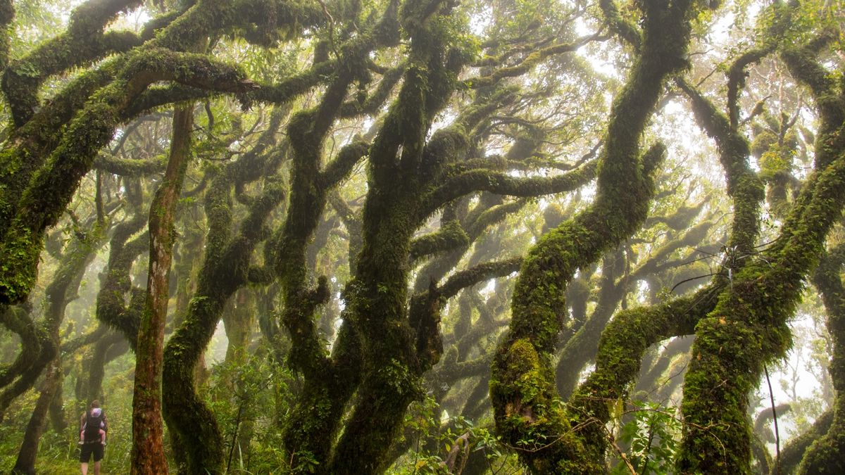
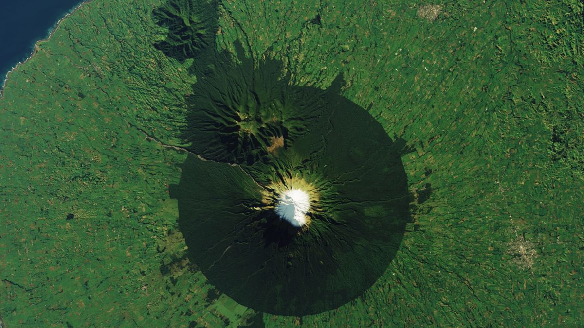
What’s in the photo? Mount Taranaki volcano surrounded by the “Goblin Forest”
Which satellite took the photo? Landsat 8
When was it taken? June 10, 2023
This striking satellite image shows the snow-capped peak of a “sacred” volcano in New Zealand, poking through an eerily circular forest containing thousands of warped, goblin-like trees.
Mount Taranaki, which was originally named Mount Egmont by British explorer James Cook in the 18th century, is an active stratovolcano located on the west coast of New Zealand’s North Island. It stands at around 8,261 feet (2,518 meters) above sea level, making it the country’s second-tallest peak behind Mount Ruapehu — a 9,177-foot-tall (2,797 m) volcano that acted as the movie double for Mount Doom in the “Lord of the Rings” movies.
The near-perfect ring of dark green surrounding Mount Taranaki’s slopes is Egmont National Park, which is around 12 miles (19 kilometers) across at its widest point. The park’s forest is largely made up of two species of large evergreen trees, rimu (Dacrydium cupressinum) and kāmahi (Pterophylla racemosa), according to NASA‘s Earth Observatory.
A section of kāmahi trees near the volcano’s summit is known as the “Goblin Forest” because the trees there are extremely twisted and deformed as a result of having to grow over and around the fossilized remains of trees that were destroyed in past eruptions. These trees are also covered in hanging mosses and liverworts, which adds to their creepy appearance.
Related: See all the best images of Earth from space

In 2017, the New Zealand government granted Mount Taranaki the “same legal rights as a person” due to its sacred status among local Māori tribes, who consider the volcano to be an ancestor and a family member, The Guardian reported at the time.
“The status is an acknowledgment of the Indigenous Māori people’s relationship to the mountain and means that harming the mountain has the same legal implications as harming the tribe,” Earth Observatory representatives wrote.
Mount Taranaki is renowned for having a near-perfect cone shape, aside from the smaller remains of two extinct volcanoes located on its northeast flank (which are visible in the satellite photo). As a result, the volcano was used as a double for the equally symmetrical Mount Fuji in Japan during the filming of the 2003 film “The Last Samurai,” according to NewZealand.com.
However, despite its uniform appearance, the volcano’s shape has changed often and dramatically over time. A 2021 study estimated that Mount Taranaki’s edifice — the part of the volcano that forms above ground — has undergone at least 16 significant deformations from past eruptions since it first formed around 135,000 years ago.
Mount Taranaki experienced its last major eruption around 200 years ago but is still considered active and sporadically spits out volcanic mudflows, or lahars. Researchers currently predict that there is a 30% to 50% chance of another major eruption in the next 50 years, which could potentially impact more than 100,000 people who live near the volcano, according to the Taranaki Emergency Management Office.

